Multimedia | interviews and talks
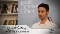
Shane McCorristine on "Dreamscapes of the Arctic"
Shane McCorristine, a Carson fellow from June to September 2010, talks about how the arctic regions were understood in the nineteenth century.
Shane McCorristine, a Carson fellow from June to September 2010, talks about how the arctic regions were understood in the nineteenth century.
Henry Clifford Darby (Sir Clifford in his later years) was—and arguably remains—Britain’s most well known historical geographer. The Relations of History and Geography consists of a dozen chapters, arranged as three sets of four essays that focus on England, France, and America. At the heart of this book lies a window onto Darby’s views of historical geography, as a field of inquiry, in the three realms over which he cast his gaze.
This book examines the various practices—social, discursive, and political—through which Canada’s West Coast forests have been given meaning and made the site of intense political and ideological struggle.

Geography and History is the first book for more than a century to examine comprehensively the interdependence of the two disciplines.
This article looks at the history of national parks in North America, particularly in relation to the size of the Canadian territory.
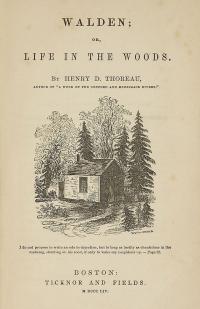
First published in 1854, Walden details Thoreau’s experiences over the course of two years in a cabin amidst woodland near Walden Pond.
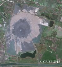
This article describes an ongoing environmental disaster in Indonesia, where a mud volcano has been inundating an ever-increasing area.

Owain Jones raises questions about the relationships between self, time, memory, materiality, and place, using a non-representational creative approach based on image and textual collage.
In this special issue on Multispecies Studies, Cary Wolfe and Maria Whiteman discuss the changing notions of landscape and nature at work in the video installation Mountain Pine Beetle and explores some of the forces that eventuated in the devastated landscapes of the Rocky Mountain West brought on by the infestation of the mountain pine beetle beginning in the early 2000s—an infestation caused, in no small part, by what some scientists have called a perfect storm of circumstances created by global warming.
Carter et al. translate key themes from scenario narratives into spatial representations using Geographic Information Systems (GIS). They apply this technique to a Tasmanian case study exploring future scenarios for biodiversity in a predominantly privately-owned agricultural landscape, enabling land managers to explore outcomes from potential interventions and identify strategies that might mitigate the impact of future issues of environmental concern.