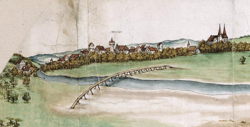
The Filstalpanorama was most likely drawn by Martin Schaffner, a painter from Ulm, around 1535. It shows the course of the river Fils from Göppingen to Gingen, and offers an incomparable insight into the landscape of the German state of Württemberg in the early sixteenth century. This excerpt shows the left-hand side of the map with a view of the northern part of the Fils valley and of Göppingen, a major administrative center in Württemberg. The confidence shown in drawing and the realism of execution are certainly admirable. Besides this, as the only coeval representation of its kind, the map also gives an impression of the environment in which the history of Württemberg took place. In this sense, it is important for the comprehension of both the environmental historical development of the Fils valley and the local history of Württemberg. The Filstalpanorama can thus be seen as exemplary of the extensive holdings of the Hauptstaatsarchiv Stuttgart and of the Landesarchiv Baden-Württemberg. An exact evaluation of these holdings in respect to their use within environmental historical scholarship, however, still largely remains to be done. Text contributed by Charlotte Hagedorn and Peter Rückert, Landesarchiv Baden-Württemberg - Hauptstaatsarchiv Stuttgart
Martin Schaffner, Ulm, Germany
from Multimedia Library Collection:
Art & Graphics


