A river has an opinion. And a big river can make that opinion felt when it breaks its banks and rebuilds a flood plain to release a pressure valve. This is normal—it’s what a river does.
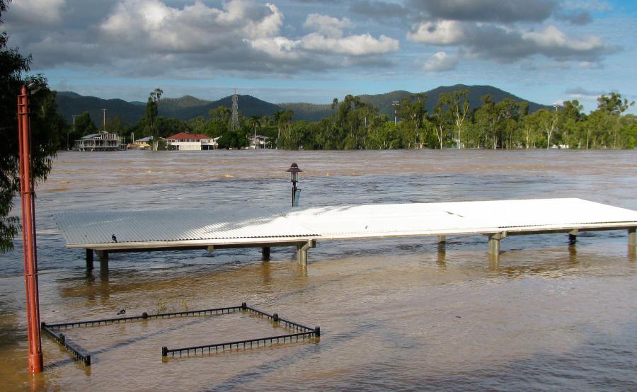
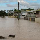
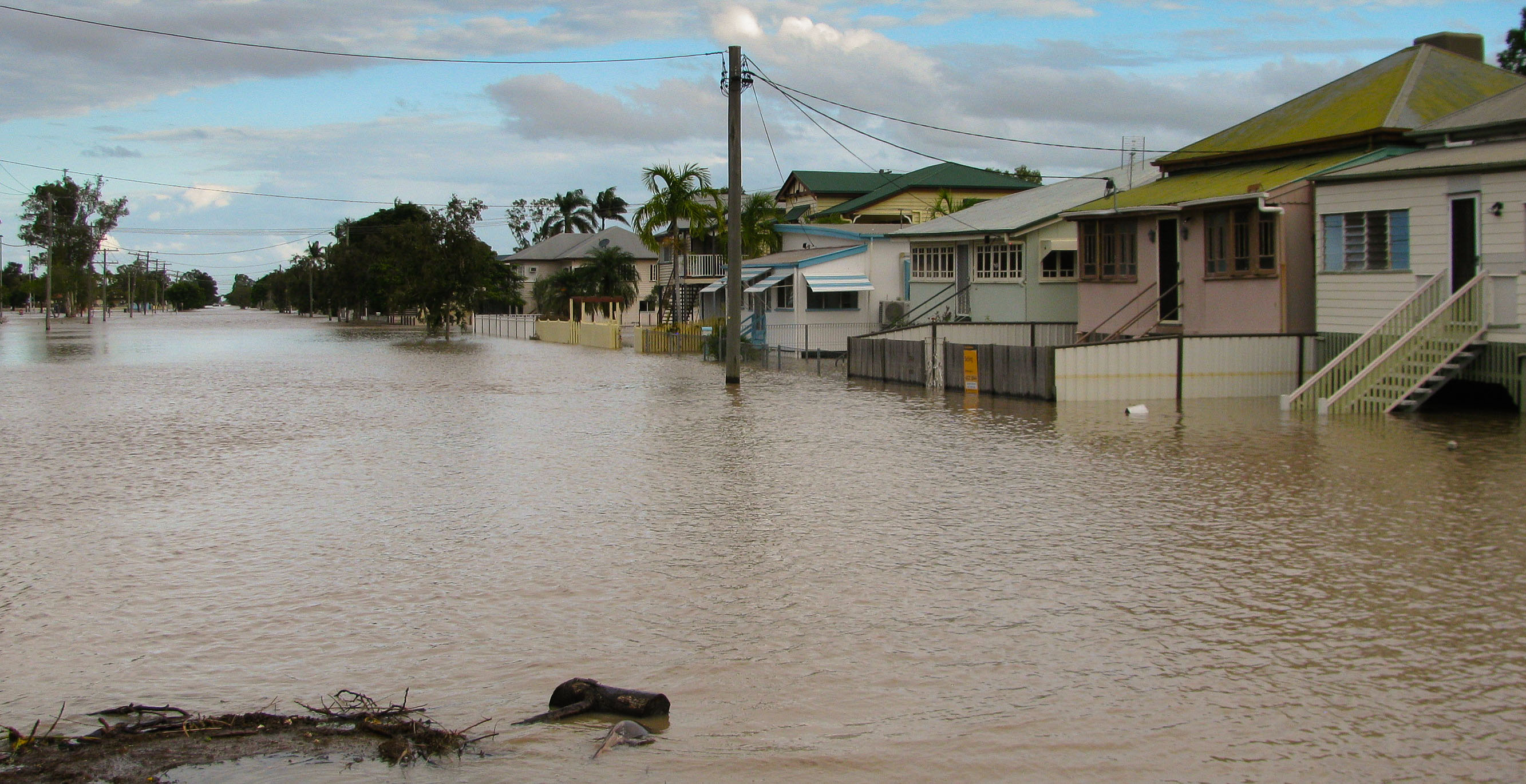
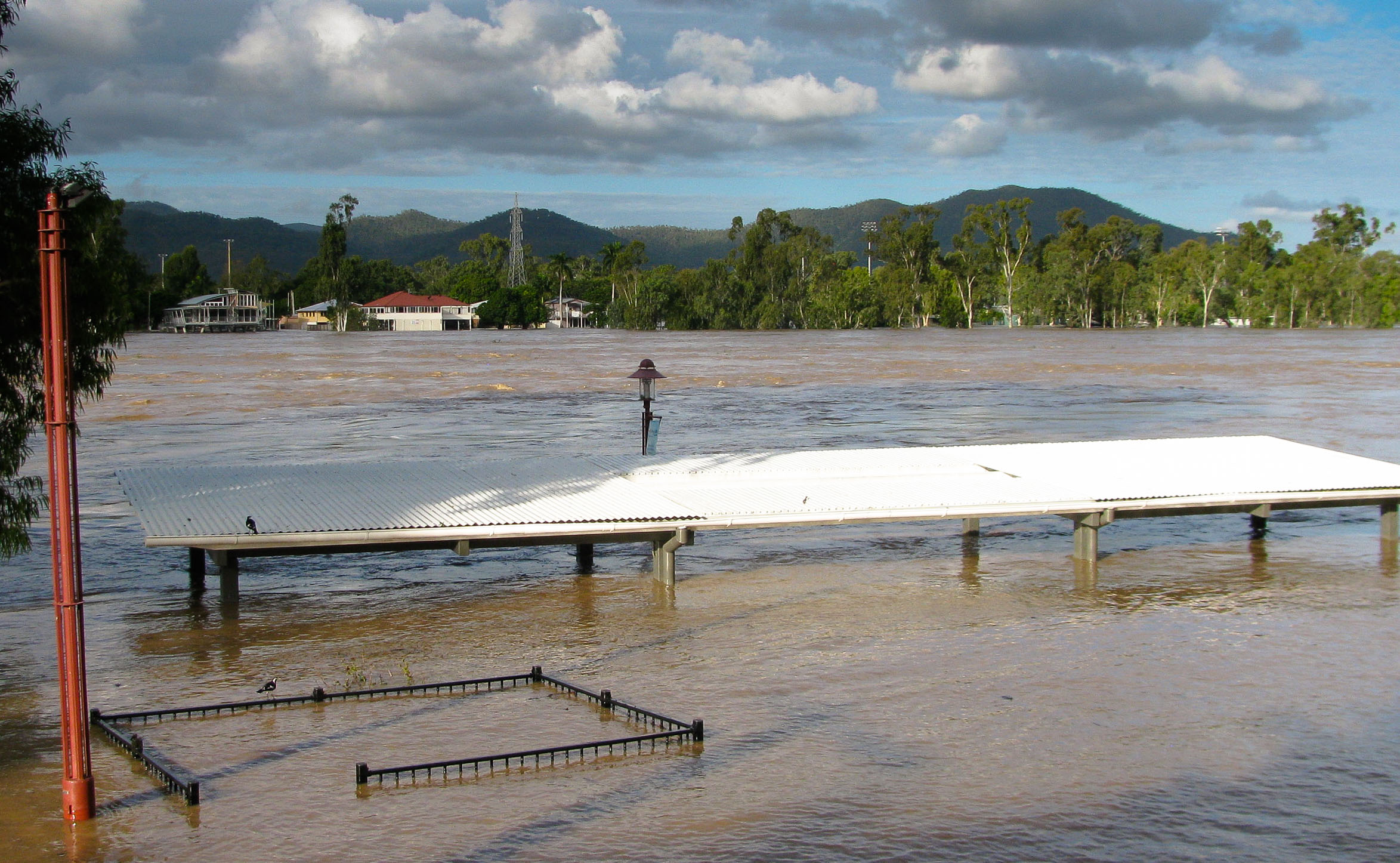
The Fitzroy River sits in the largest drainage basin that flows to the east coast of Australia—and it can be a coffee-colored maelstrom in times of flood. In late March 2017, Tropical Cyclone Debbie wandered inland and soaked the upper reaches of the massive catchment. It took a whole week for the upstream deluge to rush through the regional city of Rockhampton and career coastward to smother the southern end of the Great Barrier Reef with its burden of sludge.
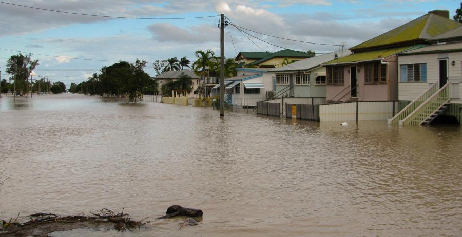
The Fitzroy River in flood at Rockhampton, 2017.
There have been many, much higher Fitzroy flood peaks in living memory and in the geological record. But still, the 2017 version was a reminder that bank-breaking floods both provide soil sustenance and can be messily murderous to human endeavor.
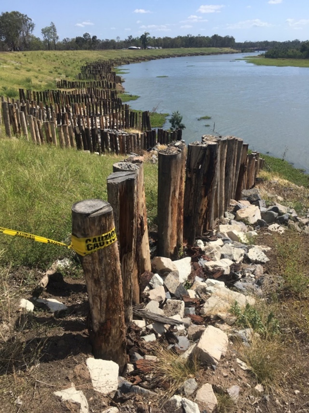
In 2019, the Fitzroy Basin Association herded its members into buses and drove them to “Site 7” at the end of a dirt road. From a riverside marquee, the natural-resource manager, charged with balancing the needs of the environment and agriculture in the basin, gleefully showed off an amelioration scheme for an eroding riverbank, expected to cover 1.2 kilometers and cost 1.8 million Australian dollars.
Amongst the celebratory speeches, a hydrology engineer described an ancient river sustaining First Nation peoples. The Darumbal know the Fitzroy by an original name, Tunuba, meaning big river.
The engineer sketched out the geomorphology of massive Fitzroy floods with the capacity to carve out a very different set of stream banks than those incising the current floodplain—he depicted an era when epically proportioned fluvial bulldozers dredged lazy meandering loops into stretches of straight-line streams. While the Tunuba of the Holocene has been relatively quiet, the narrative noted that a floodplain is composed of eons of overflow.
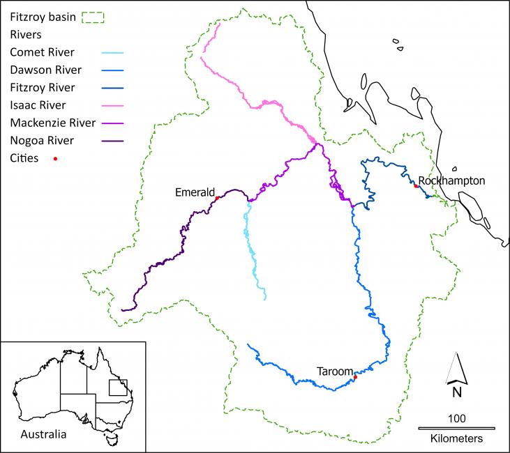
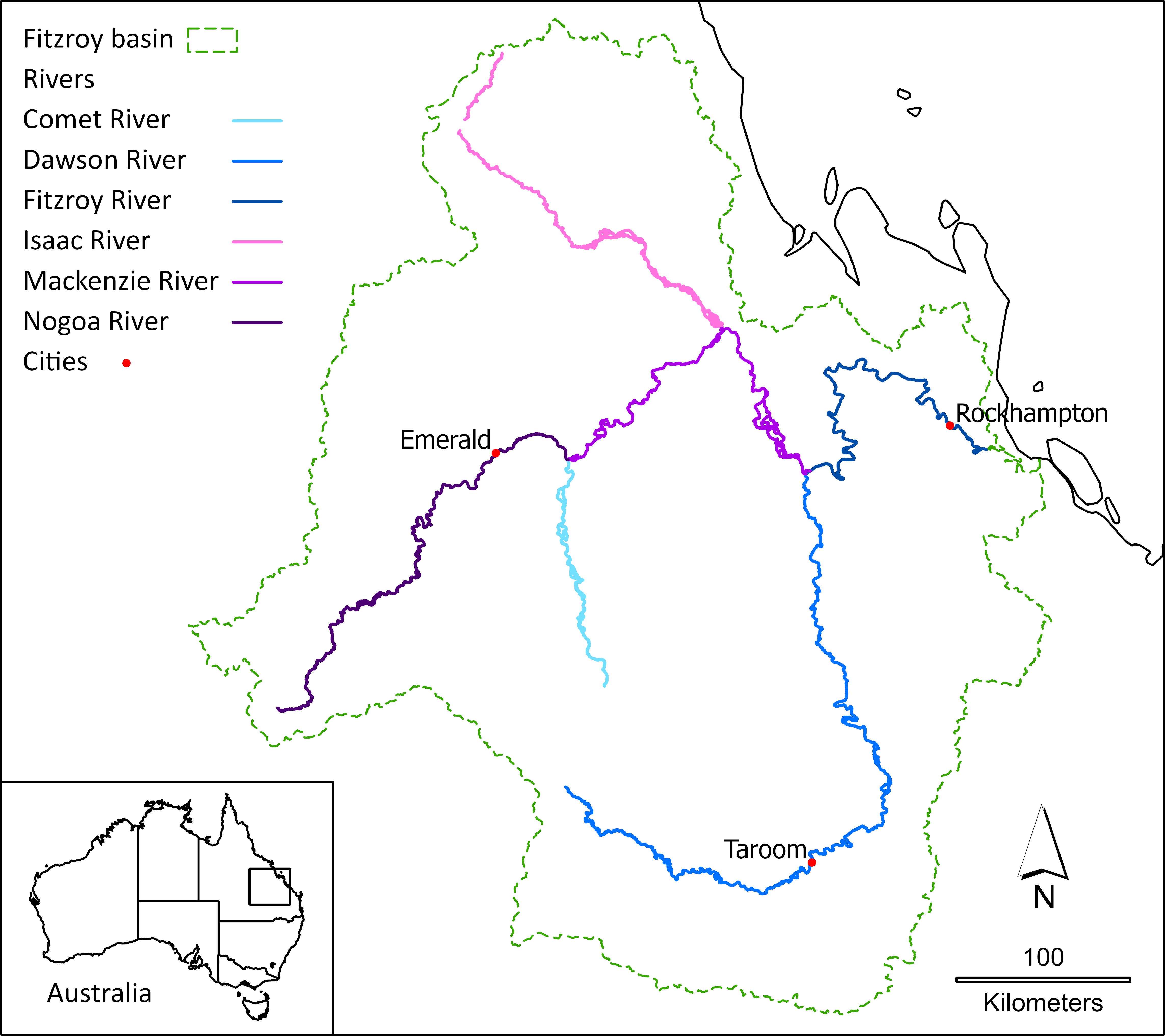
The Fitzroy River Basin of the state of Queensland, Australia.
Yet, he said, recent anthropogenic activity has created these “peaky” rivers in the eyeblink of a couple of hundred years. Flood levels rise more quickly because bush clearing upstream causes water to sheet into the river rather than soaking into tree-root-covered land. This human activity creates higher water energy, which speeds more sediment to the sea.
The engineer changed tack to describe the neat rows of wooden pier poles rammed into the bank at Site 7. They would reduce the high-energy erosion, thus depositing silt on the banks and creating stability for vegetation. Grasses would grow, then reeds, shrubs, and trees—this surface roughness, with strength like steel reinforced with concrete, would further slow the flow of a river.
A tear-wiping, feel-good project to limit erosion and reduce sediment flow to the reef…
But hang on… The ancients saw floods that altered river routes—and now we bury piddling piles to strategically contain streamflow? About a kilometer of work—on how much river? For how much money? So, how much sludge will be rerouted from the reef?
And yet, are these works right for the river? Does a river not make its demands and determine its own path? A young river revels in its catchment—but with a wiser girth, older water wants to wander. In times of excess, a river seeks to swiftly egress—an entirely normal hydrological event.
In the Anthropocene, the floodplain is where we plant infrastructure—to eat, sleep, work, and play. Riverbank shape-shifting has thus become highly unwelcome—for both rivers and humanity! Arguably, if there were no landholdings on the floodplain, there would be no need to manage riverbanks.

Fitzroy Basin Association Site 7 on the Fitzroy River near Rockhampton, Australia, 2019.
Fitzroy Basin Association Site 7 on the Fitzroy River near Rockhampton, Australia, 2019.
© 2019 Michael Hewson. Used by permission.
The copyright holder reserves, or holds for their own use, all the rights provided by copyright law, such as distribution, performance, and creation of derivative works.
While stories abound of First Nations warnings that have been sadly ignored, there is some past colonial Australian experience. In 1810, Governor Macquarie planned five towns on high ground along the Hawkesbury and Nepean Rivers to floodproof new settlements. Macquarie did not get his planning passed by the government of the day—and now, with three successive years of devastating floods in 2020, 2021, and 2022, modern residents sure wish he had succeeded. The town of Gundagai was relocated to higher ground after the Murrumbidgee River flooded in June 1852 and more than a third of its population drowned. Clermont, Queensland, was similarly shifted in 1916. The Queensland Lockyer Valley Regional Council offered a voluntary uphill land swap to residents of Grantham, hard-hit by floods in 2011.
According to modelling, climate change will continue exacerbating floods on the east coast… Therefore, floodplain policy is imperative. Site 7, all things considered, is a puny prototype for protecting property boundaries—to ameliorate agricultural land loss to river-created cadastre change. Thus, humans will be fighting the river for its space.
The alternative? Arguably, quiet restitution resides in two public-policy imperatives.
Firstly, rivers could be ceded their whole highway as a property rights principle. The Iwi of Te Awa Tupua (Whanganui River, Aotearoa New Zealand) achieving rights for a river is a precedent for this.
And secondly, upstream land care in which the connectivity and ecology of a river system are holistically recognized could be practiced—not just some de-sludging to treat the symptoms of a larger issue. Much can be learned from expressions of legal and policy rights for rivers in South America, Canada, India, and other places.
The Fitzroy River in flood at Rockhampton, 2017.
In Australia, legislation is needed to specifically lease the river-owned property as biodiversity conservation and cultural zones. The rules would regulate floodplain farming—replete with fair overflow reparation and fiscal-loss mechanisms. This would all take place on a loan basis—not as freehold ownership.
Now and then, a river reclaims what is its own and laughs at restrictive controls. Here in Rockhampton, Tunuba owns what it makes.
How to cite
Hewson, Michael. “River Rights at Rockhampton (a Rhetoric).” Environment & Society Portal, Arcadia (Spring 2023), no. 4. Rachel Carson Center for Environment and Society. doi:10.5282/rcc/9565.
ISSN 2199-3408
Environment & Society Portal, Arcadia
 This work is licensed under a Creative Commons Attribution 4.0 International License.
2023 Michael Hewson
This refers only to the text and does not include any image rights.
Please click on an image to view its individual rights status.
- Brara, Rita, and María Valeria Berros. “A World Parliament of Rivers.” Springs: The Rachel Carson Center Review, no. 1 (2022). https://springs-rcc.org/a-parliament-of-rivers-legal-personhood-and-beyond/.
- Cook, Margaret. A River with a City Problem: A History of Brisbane Floods. Brisbane: University of Queensland Press, 2019.
- Macpherson, Elizabeth, Erin O’Donnell, Lee Godden, and Lily O’Neill. “Lessons from Australian Water Reforms: Indigenous and Environmental Values in Market-Based Water Regulation.” In Reforming Water Law and Governance: From Stagnation to Innovation in Australia , edited by Cameron Holley and Darren Sinclair, 213–34. Singapore: Springer, 2018.
- O’Gorman, Emily. Wetlands in a Dry Land: More-than-Human Histories of Australia’s Murray-Darling Basin. Weyerhaeuser Environmental Books, edited by Paul S. Sutter. Seattle: University of Washington Press, 2021.


