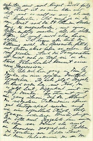
NL001-004_093
Source: Alfred Wegener, Tagebücher, June 1906 – August 1908. DMA NL 001/004.
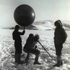
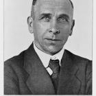
[093] arbeiten sind auch längst nicht fertig. Heut ist es nun klar und still, und es sieht so aus, also sollte ich beobachten. Ich muß ja in diesem Monat noch die 24 Stunden Beobachtung, die magnetischen, und einen Ballonaufstieg machen, alles bei stillem Wetter, ich muß mich also heranhalten. Ich traue aber heute der Witterung nicht. Das Barometer fällt und gestern abend haben wir einen Mondring gesehen. Auch die Temperatur ist nicht mehr so tief wie in der Nacht. Wahrscheinlich kommt eine neue Depression. Ich lebe doch hier ganz in dem Gedanken an eine spätere deutsche Expedition. Ich habe jetzt Drygalskis Buch wieder hier, und Koch, der es jetzt liest, disputiert mit mir eifrig darüber. Er stimmt mit mir ganz überein, daß der Abbruch des südpolaren Inlandeisees ebenso gut kartographiert werden muß wie eine eigentliche Küste, trotz etwaiger säkularer Verschiebungen. Dies hätte auch Drygalski tun müssen. Bei ihm war damit aber auch ein besonderes geographisches Problem, die Existenz von Wilkes-Land, auf dessen Vorhandensein das von der
[093] work is not even close to being finished. Today it is clear and still, and it looks as though I should make observations. I still have to carry out the 24-hour observation, the magnetic observations and one balloon deployment this month, all in calm weather, and so I must keep going. I don’t trust the weather conditions today though. The barometer is dropping and yesterday evening we saw a moon halo. The temperature is also not as low as during the night. A new trough is probably approaching. I am living here completely absorbed in thoughts of a future German expedition. I have Drygalski’s book here again, and Koch, who is reading it now, is eagerly disputing it with me. He agrees with me completely that the edge of the South Polar inland ice lake must be mapped just as much as an actual coast, despite possible long-term shifts. This should have been done by Drygalski. For him, however, there was a special geographical problem to be solved, namely the existence of Wilkes Land, which was suggested by the sighting of the “high land” from the
The Wegener Diaries: Scientific Expeditions into the Eternal Ice
This virtual exhibition sheds light on Alfred Wegener’s expeditions to Greenland between 1906 and 1931. Its main focus is on the diaries Wegener wrote during his explorations, which offer unique insights into the manifold challenges man and material faced in Greenland’s extreme environments. You may choose to read the diaries in their original state, or browse the expeditions individually and read transcribed and translated excerpts by clicking on the individual chapters.
This version, published in 2020, includes minor updates to the original 2013 virtual exhibition. PDFs of the virtual exhibition, as well as original scans and transcripts of the Wegener Diaries, can be found at the exhibition’s PDF Depot.
Christian KehrtAbout the author