
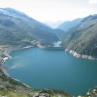
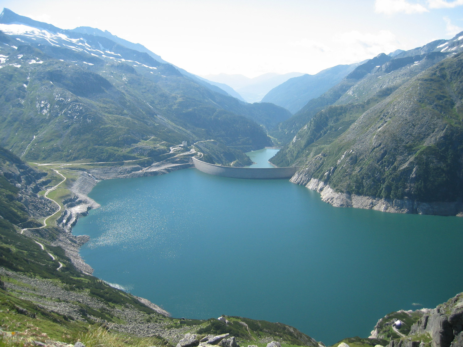
Koelnbrein dam and Galgenbichl reservoir as seen from the Arlhoehe
Koelnbrein dam and Galgenbichl reservoir as seen from the Arlhoehe
2005 Michael Glanznig
Click here to view Wikimedia source.
 This work is licensed under a Creative Commons Attribution 2.0 Austria License.
The Möll rises in the Hohe Tauern and flows eighty kilometers through the Austrian Alps. Today, six hydropower plants divert the waters of the river and its tributaries, providing 18 percent of Austria’s total hydropower capacity.
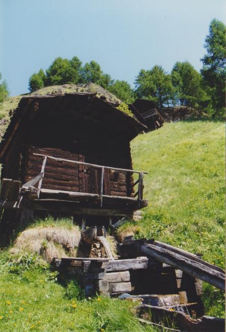
Old wooden house mill near Apriach, Carinthia, Austria
Old wooden house mill near Apriach, Carinthia, Austria
Some of the old wooden house mills in the upper Moell valley remained. They were restored as cultural heritage in recent years.
All rights reserved © 2002 Sabine Preis, Institute of Hydrobiology & Aquatic Ecosystem Management.
The copyright holder reserves, or holds for their own use, all the rights provided by copyright law, such as distribution, performance, and creation of derivative works.
Around 1830, the twenty-five villages along the Möll produced their energy with 750 mechanical hydropower facilities, powering small house mills, twenty forges, and several sawmills and mechanical threshing machines. On average, every second building had its own grain mill, none of them directly in the river due to its swift current. Locals coped with floods and landslides by avoiding endangered sites for the sake of energy and useable land, a scarce commodity in Alpine environments. The invention of electricity and its transmission over large stretches allowed inhabitants to search for optimal production places, as these no longer needed to be closely connected to the places of consumption. Under the Austro-Hungarian monarchy, the use of hydroelectricity was delayed due to rich coal sources. Nevertheless, the potential was intensively discussed and engineers systematically measured the flow and slopes of rivers. The collapse of the monarchy cut the country off from coal sources in Bohemia, Moravia, and Silesia.
Hydropower production was the perfect alternative, and gigantic projects were developed. The Hohe Tauern were immediately the object of energy dreams. Reports referred, in particular, to the enormous drop heights and the potential for tapping the precipitation from both sides of the mountain.

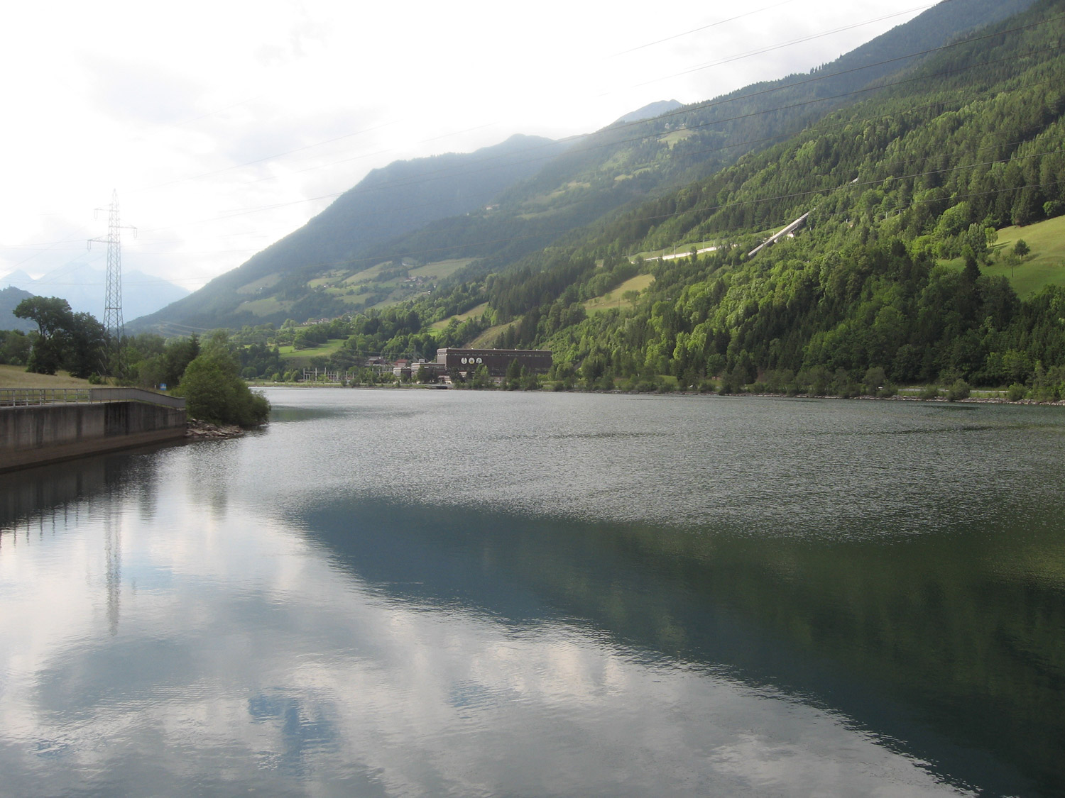
Impoundment Lake Rottau and hydropower station
Impoundment Lake Rottau and hydropower station
Large tubes transport water from Koelnbrein reservoir and divert brooks to the hydropower station in the valley (centre).
2007 Jarlhelm (wikipedia username)
Click here to view Wikimedia source.
 This work is licensed under a Creative Commons Attribution-NonCommercial-ShareAlike 2.5 Generic License.
In 1928, the first plans for the Kaprun power plant were commissioned. Although completed only after World War II, it started the nationalisation of electricity production in the Möll valley. The large reservoirs and dams, as well as the huge tubes for water diversion, changed the landscape drastically. Water abstraction and dykes modified the ecological conditions and threatened animal and plant species specific to the locality. The side-effects of clean, renewable “white coal” are particularly profound in steep alpine valleys.
How to cite
Haidvogl, Getrud. “From Grains to Riches: How Hydropower Production on the Möll River in the Austrian Alps Went from Local to Supra-Regional.” Environment & Society Portal, Arcadia (2011), no. 6. Rachel Carson Center for Environment and Society. https://doi.org/10.5282/rcc/2771.
ISSN 2199-3408
Environment & Society Portal, Arcadia
 This work is licensed under a Creative Commons Attribution-NonCommercial-ShareAlike 3.0 Unported License.
2011 Gertrud Haidvogl
This refers only to the text and does not include any image rights.
Please click on the images to view their individual rights status.
- Jungmeier, Michael. “Die Kulturlandschaft der Nationalparkregion Hohe Tauern in Kärnten. Bedeutung und Entwicklung nachhaltig genutzter Landschaftsräume im ‘Vorfeld’ eines Schutzgebietes – Das Beispiel der Nationalparkregionen Oberes Mölltal und Mallnitz-Hochalmspitze.” In Kärntner Nationalparkschriften, vol. 9. Großkirchheim: Kärntner Nationalparkfond, 1997.
- Rigele, Georg. “Der Marshallplan und Österreichs Alpen-Wasserkräfte: Kaprun.” In 80 Dollar. 50 Jahre ERP-Fonds und Marshall Plan in Österreich, edited by Günther Bischof, and Dieter Stiefel, 183–216. Wien: Ueberreuter, 2001.
- Tuppinger, Hans, ed. Reisseck im Wandel der Zeit. Kolbnitz: Verschönerungsverein, 2001.


