The CB&Q, Buffalo Bill, and the Development of Wyoming
William F. Cody (1846–1917) was one of the most colorful characters of late nineteenth and early twentieth-century America. In the late 1860s, Cody purportedly killed more than four thousand American bison for the Kansas Pacific Railroad. The near extermination of bison is an important environmental story, and railroads are important to that story. However, while Cody was slaughtering his bison the CB&Q was still east of the Missouri River. Indeed, by the time the company laid tracks into Nebraska, most of the bison were already gone.
After participating in the near extermination of bison and the native peoples who depended on them, Cody gradually came to celebrate both. He drew upon his early experience as a scout for the US military and a bison hunter to build a career as a showman beginning with his stage debut in Chicago in 1872. As “Buffalo Bill,” Cody started his show “Buffalo Bill’s Wild West” in 1883. The show toured throughout the United States and Europe, making Cody an international celebrity. Essentially a vaudeville circus, Cody employed Sitting Bull and Sioux warriors to reenact frontier conflicts. In some shows Cody played General Armstrong Custer and his Last Stand at the Little Big Horn. After the massacre at Wounded Knee, Cody’s show began to focus less on conflicts with Native Americans and more on reconciliation. In 1893 he renamed the show Buffalo Bill’s Wild West and Congress of Rough Riders of the World and featured an international cast of performers. Cody was a major customer for the railroads: in 1896 alone his show traveled ten thousand miles and made 132 stops.
During these journeys, Cody was “a favorite and frequent guest” in the business car of Charles Elliot Perkins. Perkins had worked his way up from a cashier to being president and director of various Burlington companies. He was a hands-on administrator, spending much of his time going over the property himself. According to Overton (1965, 241), in addition to Cody, Perkins entertained a “Who’s Who of the West” including “judges, politicians, literary men, and ‘local characters.’” They played poker and presumably made business deals.

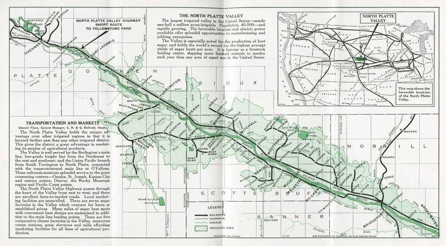
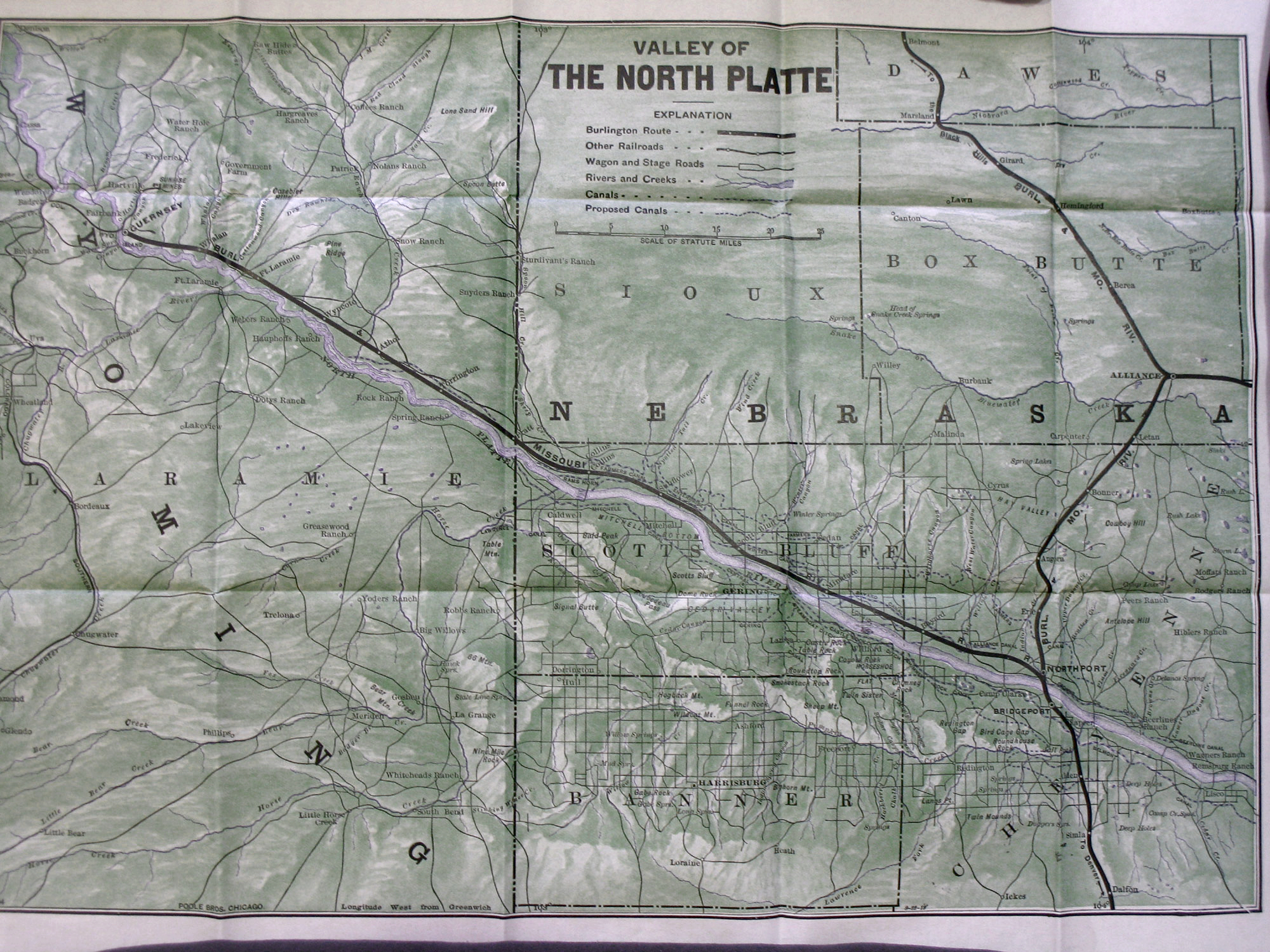
Map of North Platte Valley, Nebraska, 1930.
Map of North Platte Valley, Nebraska, 1930.
Courtesy of Newberry Library Chicago. CB&Q Misc. Bx. #4.
Used with permission of the Newberry Library. With questions about reuse of this image, contact the Newberry Library.
The copyright holder reserves, or holds for their own use, all the rights provided by copyright law, such as distribution, performance, and creation of derivative works.
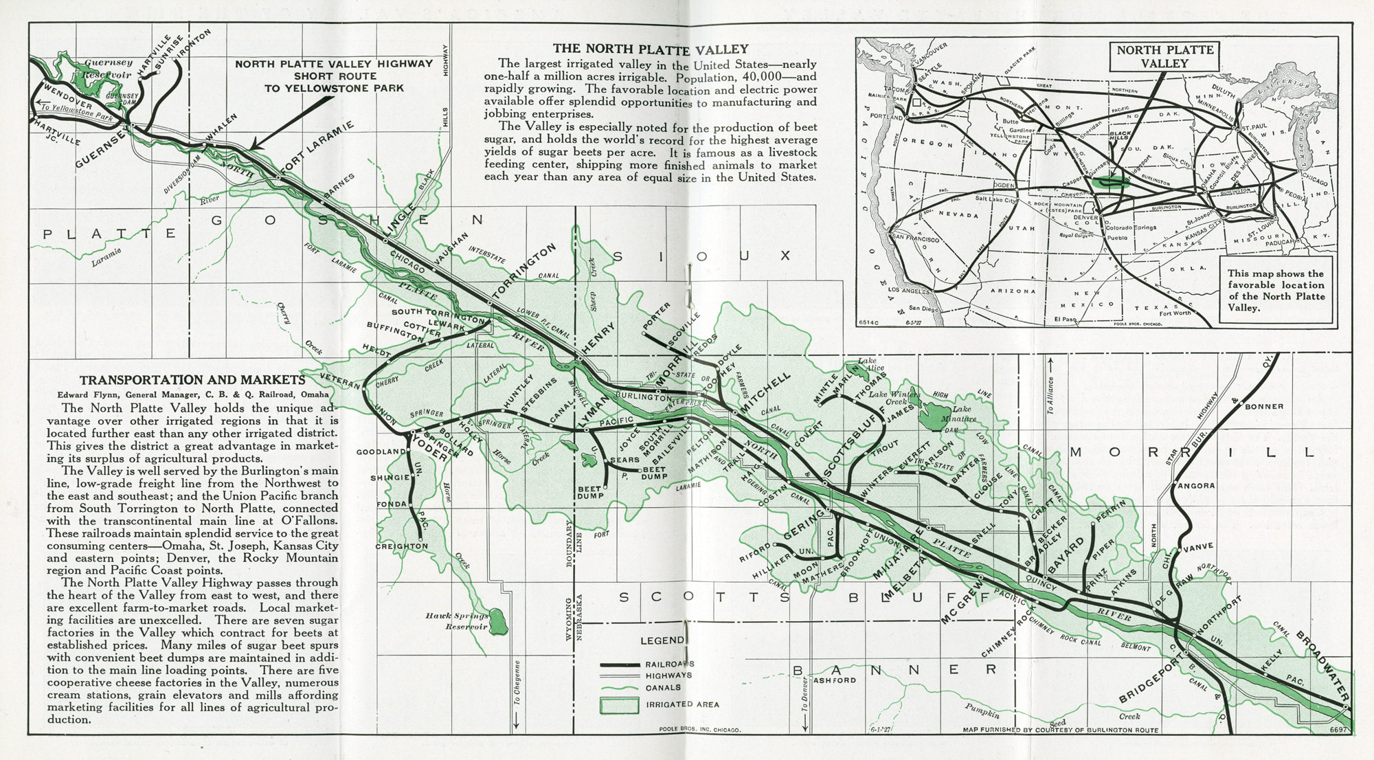
Map with detailed view of North Platte Valley, Nebraska, 1930.
Map with detailed view of North Platte Valley, Nebraska, 1930.
Courtesy of Newberry Library Chicago. CB&Q Misc. Bx. #4.
Used with permission of the Newberry Library. With questions about reuse of this image, contact the Newberry Library.
The copyright holder reserves, or holds for their own use, all the rights provided by copyright law, such as distribution, performance, and creation of derivative works.
After most of the Burlington’s land grant parcels were sold, the company turned its attention to promoting the development of lands further west. Even if the company was no longer in the real estate business, increased settlement and development would expand their freight and passenger business. Irrigation began soon after settlement in the North Platte Valley, and local interests built water wheels and canals to help increase the productivity of their agricultural lands. After Wyoming Senator F. E. Warren helped pass the National Reclamation Law, the federal government stepped in and developed ambitious dam and irrigation projects, which brought water to over two hundred thousand acres by the mid-1920s.
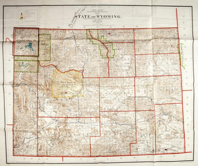
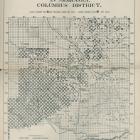
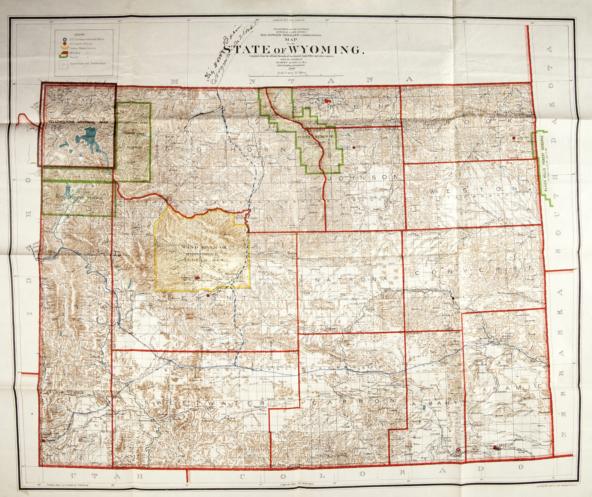
U.S. Department of the Interior General Land Office, map of Wyoming, 1900.
U.S. Department of the Interior General Land Office, map of Wyoming, 1900.
Courtesy of Newberry Library Chicago. CB&Q Railroad 3 H5.18, George Harris, Letters, Bx.#9 Fl.263.
Used with permission of the Newberry Library. With questions about reuse of this image, contact the Newberry Library.
The copyright holder reserves, or holds for their own use, all the rights provided by copyright law, such as distribution, performance, and creation of derivative works.
This map suggests a “new frontier” with military posts, US land offices, US Surveyor General office, and unsurveyed lands ready to be developed. At the same time, the newly established forest reserves show evidence of efforts to preserve wild lands. Note the road sketched in through part of the Shoshone Wind River Reservation, and the solid line showing a road to the newly established town of Cody.
William F. Cody claimed that after describing the wonders of the Big Horn Basin to CB&Q President C. E. Perkins, Perkins told Cody that if he would help settle the Basin, Perkins would build a road to it. According to Cody historian Robert E. Bonner, in reality it may have been the other way around. Bonner argues that the CB&Q recognized the agricultural and mineral potential of the region and the possibility of a line into Yellowstone along the north fork of the Shoshone River, and observed that they could capture this traffic by extending a line from Montana.

CB&Q map of Big Horn Basin, 1902.
CB&Q map of Big Horn Basin, 1902.
Courtesy of Newberry Library. CB&Q, Brochures.
Used with permission of the Newberry Library. With questions about reuse of this image, contact the Newberry Library.
The copyright holder reserves, or holds for their own use, all the rights provided by copyright law, such as distribution, performance, and creation of derivative works.
This map is featured in the brochure “The Big Horn Basin Wyoming—Burlington Route.” In the original document the map is flanked by two columns of text on the left and right.
The left column bears the heading “Government Land” followed by sections on “Laws providing for the acceptance, reclamation, and disposal of arid lands,” such as the Cary Law. It provides a brief description of the Big Horn Basin Development Company and the Shoshone Irrigation Company, the later based in Cody, Wyoming, founded in the mid-1890s by W. F. Cody, and incorporated in 1901. The two columns to the right of the map are dominated by a letter from Buffalo Bill promoting the Shoshone Irrigation Company dated 17 December 1901, with a picture of Colonel Cody in the snow holding a gun.
Detail, CB&Q brochure promoting Big Horn Basin, 1902.
Detail, CB&Q brochure promoting Big Horn Basin, 1902.
Courtesy of Newberry Library Chicago. CB&Q Brochures.
Used with permission of the Newberry Library. With questions about reuse of this image, contact the Newberry Library.
The copyright holder reserves, or holds for their own use, all the rights provided by copyright law, such as distribution, performance, and creation of derivative works.
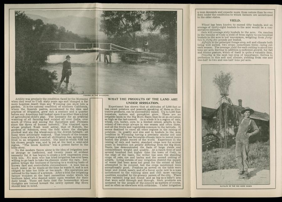
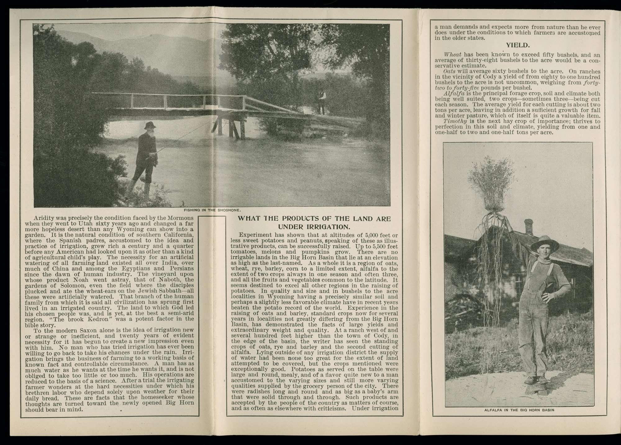
Three of sixteen panels on the other side of the (previous) map/brochure extol the virtues of irrigation. The text suggests several crops that might be grown in the irrigated lands of Wyoming, including sweet potatoes, peanuts, tomatoes, melons, and pumpkins, as well as the proven crops of wheat, rye, barley, corn, and alfalfa.
It reads: “under irrigation a man demands more from nature than he ever does under the conditions to which farmers are accustomed in the older states.”
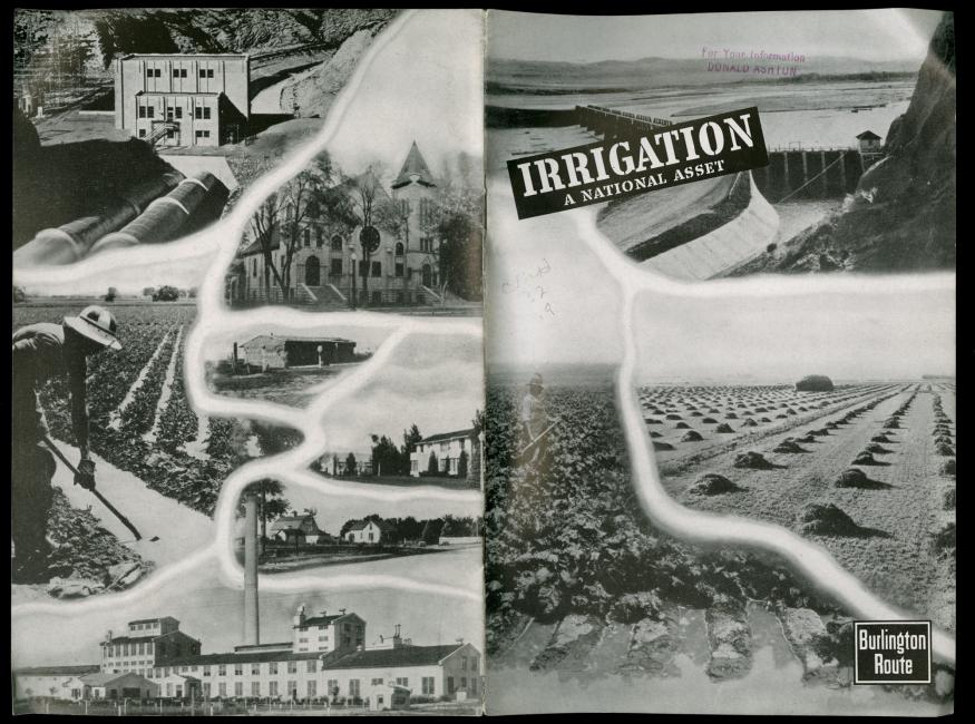
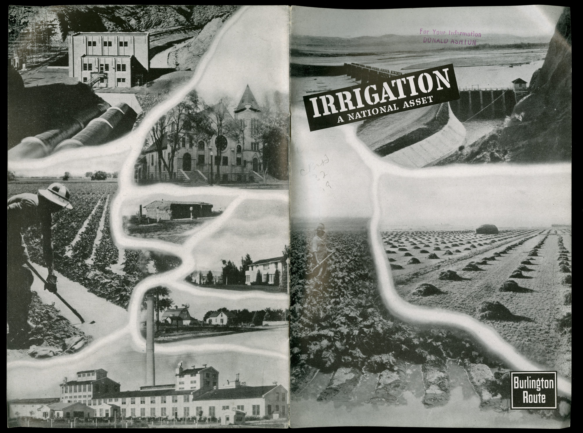
Irrigation promoted as a national asset, 1945.
Irrigation promoted as a national asset, 1945.
Courtesy of Newberry Library Chicago. CB&Q 32.92.
Used with permission of the Newberry Library. With questions about reuse of this image, contact the Newberry Library.
The copyright holder reserves, or holds for their own use, all the rights provided by copyright law, such as distribution, performance, and creation of derivative works.
This Burlington publication, published at the end of World War II, is another example of how the company promoted the transformative powers of irrigation, illustrating how profoundly irrigation altered the environment. The Burlington collection documents the company’s involvement in promoting irrigation to increase the productivity of arid lands.

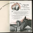
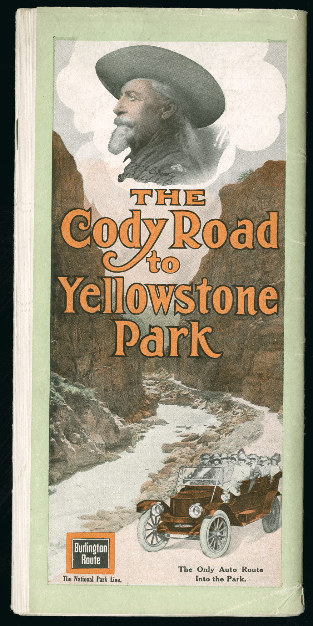
A 1916 cover of a brochure from the Chicago, Burlington and Quincy Railroad
A 1916 cover of a brochure from the Chicago, Burlington and Quincy Railroad
Newberry Library. CB&Q Brochures.
All rights reserved. Used with permission of the Newberry Library. With questions about reuse of this image, contact the Newberry Library.
The copyright holder reserves, or holds for their own use, all the rights provided by copyright law, such as distribution, performance, and creation of derivative works.
The brochure illustrated with this map begins: “there is a new way into Yellowstone Park—a way with a rugged charm all its own, and with advantages that must commend it particularly to those who prefer to be leaders of the general tide of travel, rather than followers after it.” The road was built through the Forest Reserve and maintained by the US government, covering 96 miles from Cody to the Lake Hotel in Yellowstone. Cody is accessible via the Burlington from 1 June to 1 September.
Promotion and Transformation of Landscapes along the CB&Q Railroad
This virtual exhibition shows some of the many ways railroads reshaped landscapes of the American West between 1847 and 1965.
This version 2, published in 2020, includes minor updates to the original 2011 virtual exhibition (view PDF here) and applies the Environment & Society Portal’s responsive layout.
Eric OlmansonAbout the author


