The Northwest Passage as a Matter of National Security
Highlights of this chapter

Expert interviews
This chapter includes videos of Elena Baldassarri’s interviews with experts on the Arctic region, including this interview with Adam Lajeunesse, Research Assistant at the Department of History, University of Calgary.

Video on national security topics
Elena Baldassarri’s original video footage explores issues of national security in the Arctic, such as the role of submarine activity in securing the Passage from the Cold War period until today.

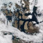
Interactive maps
Interactive maps like this one illustrating the SS Manhattan’s route through the Northwest Passage, give the reader the opportunity to explore the Arctic.

Mapping agreements
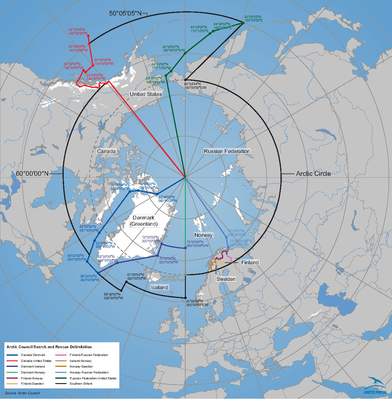
This map shows areas of application of the Arctic Search and Rescue (SAR) Agreement, the first legally binding agreement established under the auspices of the Arctic Council. It was signed on 12 May 2011 at the Arctic Council Nuuk Ministerial Meeting.

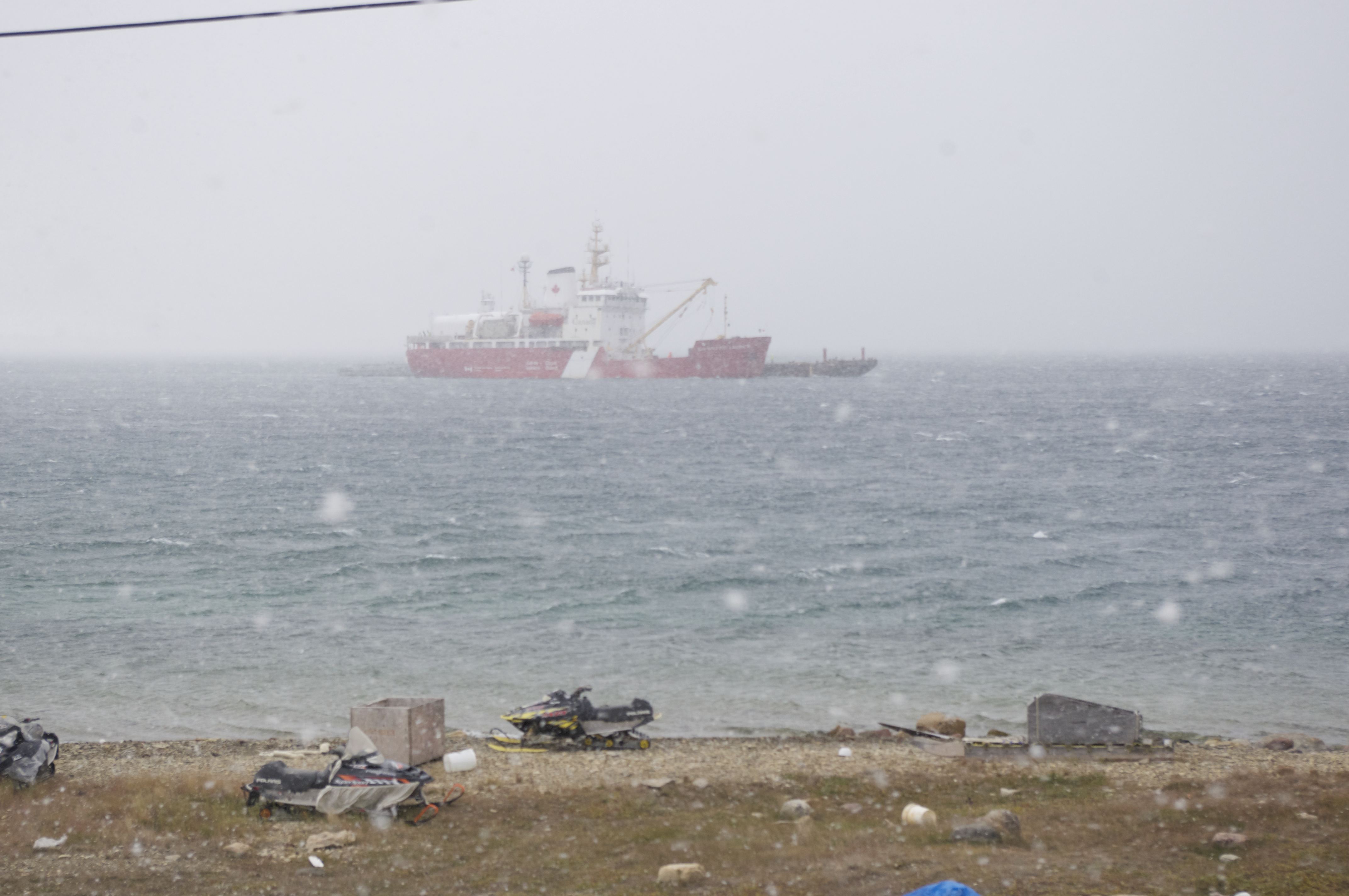
Contemporary photographs
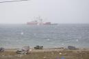
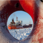
Photographs by Elena Baldassarri and Enrico Mariotti give a glimpse of the Canadian Arctic today. Here, a Canadian icebreaker can be seen from the coast of Cambridge Bay in August 2013. Photo by Enrico Mariotti.
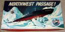
The board game Northwest Passage!
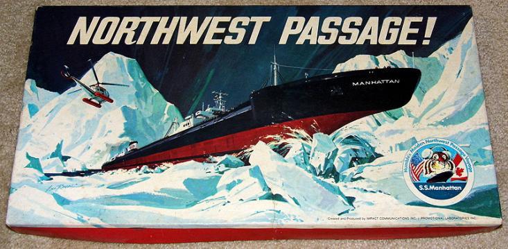
In addition to visualizing the Northwest Passage digitally, you can also explore it offline. This 1969 board game’s tasks include transporting oil from Alaska to Humble City through the Northwest Passage. Whatever happened to the SS Manhattan, the world’s largest icebreaking tanker?


Security
Historical Background
Submarines
The SS Manhattan
Inuit Perspectives
Security
Neither the United States nor Canada looked on the North as a place to be protected because of some intrinsic value. Rather it was seen as a direction, as an exposed flank.
—Kenneth C. Eyre
Security, which in the period after World War II and during the Cold War was thought of in terms of military power, confrontation, and strategic policy, has today become a much more complex question. In the context of the Northwest Passage, security priorities have been extended from traditional concerns to newer ones related to the changing environment. The result of this is the systematic consolidation of nature as a military entity. The early period of the Cold War saw attempts to overcome what was perceived to be a hostile environment. As Kenneth Eyre observes, “neither the United States nor Canada looked on the North as a place to be protected because of some intrinsic value. Rather it was seen as a direction, as an exposed flank” [Kenneth C. Eyre, “Forty Years of Military Activity in the Canadian North, 1947–87,” Arctic 40, no. 4 (1987): 294].
As the polar ice recedes, the exploitation of resources increases, and the Arctic is a vast territory that is rich in oil and minerals. It is traversed by national boundaries and commercial shipping lines, but is also a vulnerable and changing ecosystem that is home to unique fish and wildlife populations. The real conflict in the Arctic today is not, in fact, between military forces, but rather between the competing needs of resource exploitation and environmental protection. The Canadian government aims to play the leading role in the region, but in order to be successful it must also demonstrate its ability to guarantee the security of the area—something that is more than a matter of simply patrolling the coasts.
Climate change is enormously worrisome for people living in the Arctic: nature’s instability generates concerns about the sustainability of many aspects of Inuits’ inherited and acquired patterns of life, extending even to the question of what it means to be an Inuit today.
Inuit have accepted military activity as part of life in the Arctic and consider monitoring and surveillance to be fundamental to the region’s survival. However, the quest for international stability and harmony does not need to emphasize military infrastructure and investment at the expense of social and economic security. Climate change is enormously worrisome for people living in the Arctic: nature’s instability generates concerns about the sustainability of many aspects of Inuits’ inherited and acquired patterns of life, extending even to the question of what it means to be an Inuit today.
During the Cold War, the Arctic was a place of direct confrontation between the superpowers, and hence a theater for operations and the development of strategic weapons. Interest in the region began during World War II, when Greenland in particular was seen as a possible point from which to launch an attack from Europe on North America. Following the end of the war with Germany, the United States sought to acquire bases as close to the Soviet Union as possible, and also to ensure some amount of control over the Northwest Passage. In 1946 the United States proposed the construction of several weather stations in the Arctic Archipelago, which would be established and operated in cooperation with Canada. The result was an agreement in 1947 that established joint weather stations at Resolute, Eureka Sound, Mould Bay, Isachsen, and Alert.
The onset of the Cold War generated pressure to balance sovereignty concerns with North American continental security imperatives because of the strategic position of the Northwest Passage between the USA and the Soviet Union. The region became the area in which the two superpowers faced one another geographically. The defense of the Arctic was inevitably linked to American security, and the Far North became a barrier against possible Soviet invasion. Canada, Denmark, and Norway, the three non-superpower Arctic coastal states, joined the North Atlantic Treaty Organization (NATO) when it was founded in 1949. The United States built up bases in Alaska, Canada, Greenland, and Iceland as an additional element of its global strategy to contain the Soviet Union.

Photo by Enrico Mariotti, 2013.
 This work is licensed under a Creative Commons Attribution 4.0 International License.
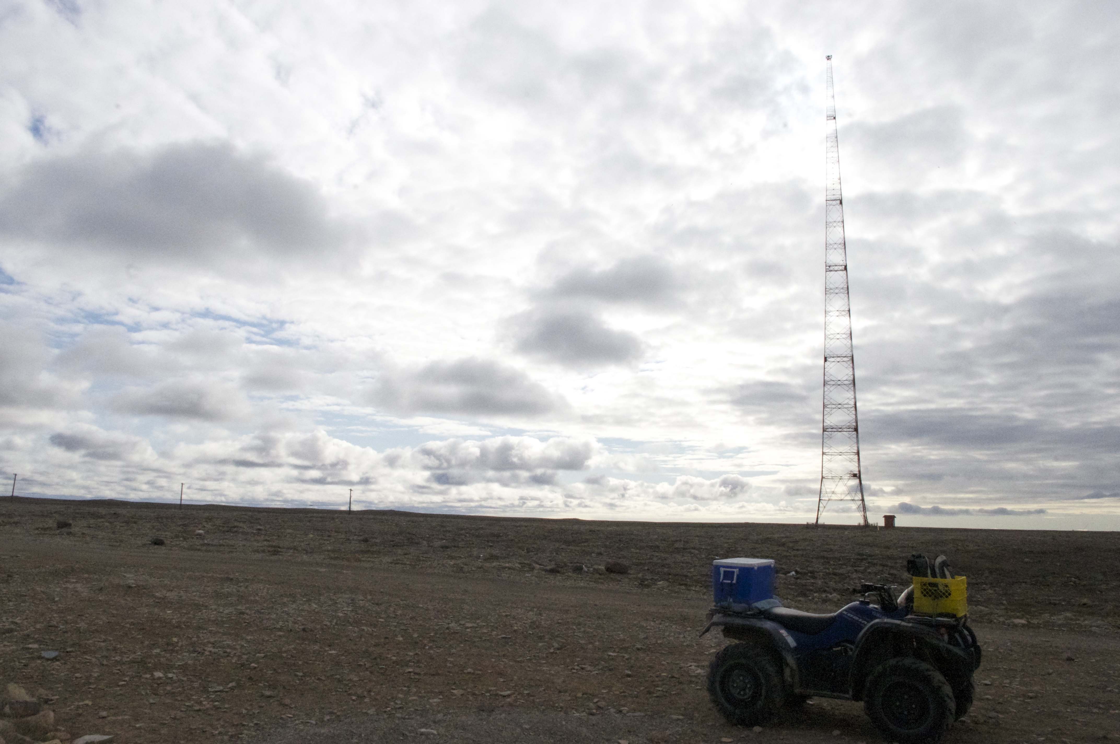
No. 28. The Cambridge Bay long-range navigation (LORAN) tower was built in 1947–48 for radio transmissions. It was 189 meters tall and was used until recently as a non-directional beacon. The tower was demolished in August 2014 because it was structurally unsound. Cambridge Bay, Nunavut. August 2013. Photos taken by Enrico Mariotti.
During the Cold War, membership in NATO and bilateral agreements with the United States guaranteed Canadian security to some extent, with no major expense for the federal government. Even if there were no risks to Canadian sovereignty, however, there were certainly important cultural and environmental consequences.
In the 1950s, the United States extended its air defense systems with the Distant Early Warning (DEW) Line, a network of radar stations along the 70th parallel designed to detect Soviet bombers. The Canadian military negotiated a favorable agreement that protected Canada’s sovereignty and secured economic benefits for Canadian companies, but opposition politicians saw this as a loss of control over the North.
The Canadian Department of National Defense saw the DEW Line as a major coup for Canadian sovereignty, because the United States, as an ally, explicitly recognized that the islands in the Arctic Archipelago belonged to Canada. While the costs of construction and operation were to be borne by the United States, Canada was to be entitled to take over its running and management in the future, which meant that port and airstrip facilities constructed for the DEW Line stations were to be available for Canadian use. The DEW Line agreement was followed by an agreement on the Ballistic Missile Early Warning System in 1959.
No. 29. The map shows the sites of the DEW Line bases and their operational period from 1957, when the system became active, to their closure in the 1990s. The construction of the 58 sites took place between 1955 and 1957, and they were declared fully operational on 31 July 1957. In 1988 the transition to the North Warning System (NWS) began, and those few DEW sites that were not integrated in the North Warning operation were eventually closed down. This work was created by Enrico Mariotti in 2014 and is licensed under a Creative Commons Attribution 4.0 International License.
The main difference between weather stations and DEW Line stations was the way their locations were selected: The selection of the sites for the weather stations was carried out by sea and based largely on places that had provided good anchorage for explorers’ vessels during the previous centuries. Aerial photographs and onsite inspections were both used in choosing the numerous locations for the DEW Line from Alaska to Greenland, with the distance between the radar facilities being regarded as the main criteria. As a result of this procedure, many of the sites of the DEW Line stations had inadequate anchorage and hence experienced major problems with the transportation of supplies. About half of the radar stations were soon abandoned for reasons of location as well as advances in radar and communication technology. However, other sites along the DEW Line in the Arctic stimulated the birth and growth of settlements, thus altering the character of formerly populated places to the advantage of new military bases. The possibility of working for the southerners, rather than fishing and trapping, encouraged the Inuit people to relocate.
The design of the new military stations posed numerous engineering problems. The Arctic’s cold climate adversely affected land, water, and people, and caused serious problems for construction and transportation. The practicability of human work was determined by ice and freezing temperatures. While surface geology and topography may favor the building of airstrips and roads, these can soon be damaged if the layer of permafrost is disturbed. With a large settlement the cost of maintenance is high, and convenient access by sea is required. A year-round supply of freshwater is essential, and the topographical features and permafrost layer must be suitable for building stable structures.
The Northwest Passage was also considered an important supply channel for the DEW Line in the event of Soviet attack, as military reinforcements could arrive by this route.
No. 30. DEW Line. Video describes the importance of the construction of the DEW Line and its impact on Inuit life and culture. Interviews with Adam Lajeunesse, Susie Maniyogina, Jimmy Maniyogina, Ana Nahogaloak, and Mary Avalak. Video by Elena Baldassarri, August 2013. This work is licensed under a Creative Commons Attribution 4.0 International License.
Submarines
American, Russian, and British nuclear submarines regularly passed beneath the Arctic Ocean ice pack during the Cold War, often traveling from ocean to ocean on secret missions. Sometimes they surfaced at the North Pole using special sonar technology to determine the point at which to break through the ice.
Cold War conflict increased the strategic importance of the Arctic and the Northwest Passage, but also created new challenges. From the late 1950s to the 1980s, the area saw attempts by Soviet nuclear submarines to sail undetected through Canadian Arctic waters, on the one hand, and the efforts of Allied Forces to prevent an attack on the other.
American, Russian, and British nuclear submarines regularly passed beneath the Arctic Ocean ice pack during the Cold War, often traveling from ocean to ocean on secret missions. Sometimes they surfaced at the North Pole using special sonar technology to determine the point at which to break through the ice.
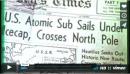
The first attempt dates back to the voyage of the USS Nautilus in 1958 from the Pacific to the Atlantic via the Bering Strait and beneath the North Pole. Even though this was more of a scientific and a media venture than a military expedition, it emphasized the strategic significance of the polar waters. The first voyage through Canadian waters was by the USS Seadragon; it sailed east to west through the Parry Channel in 1960. Its success soon raised the question of regular naval operations in a potentially important new maritime region.
The fact that the nuclear submarines of several countries were probably transiting Canadian waters on a regular basis has led to major speculation about US threats to Canadian sovereignty, but recent work by historians, and records recently made available, show that most of the voyages were made with Canadian permission.
The increase in technological conflict and the activities of US and Soviet submarines in the Arctic saw a decrease in the importance of the DEW Line as a security measure, with the realization that the main threat would come from intercontinental missiles rather than bombers. For this reason, the Canadian and US navies continued to cooperate on the development of under-ice detection systems to improve anti-submarine capabilities, and ultimately on the creation of an operational submarine detection network.
No. 31. Security Submarine. Importance of submarine activity in securing the Passage from the Cold War period to today. Interviews with Adam Lajeunesse, Franklyn Griffiths, Ray Snook, John Higginbotham, and James Manicom. Video by Elena Baldassarri, August 2013. This work is licensed under a Creative Commons Attribution 4.0 International License.
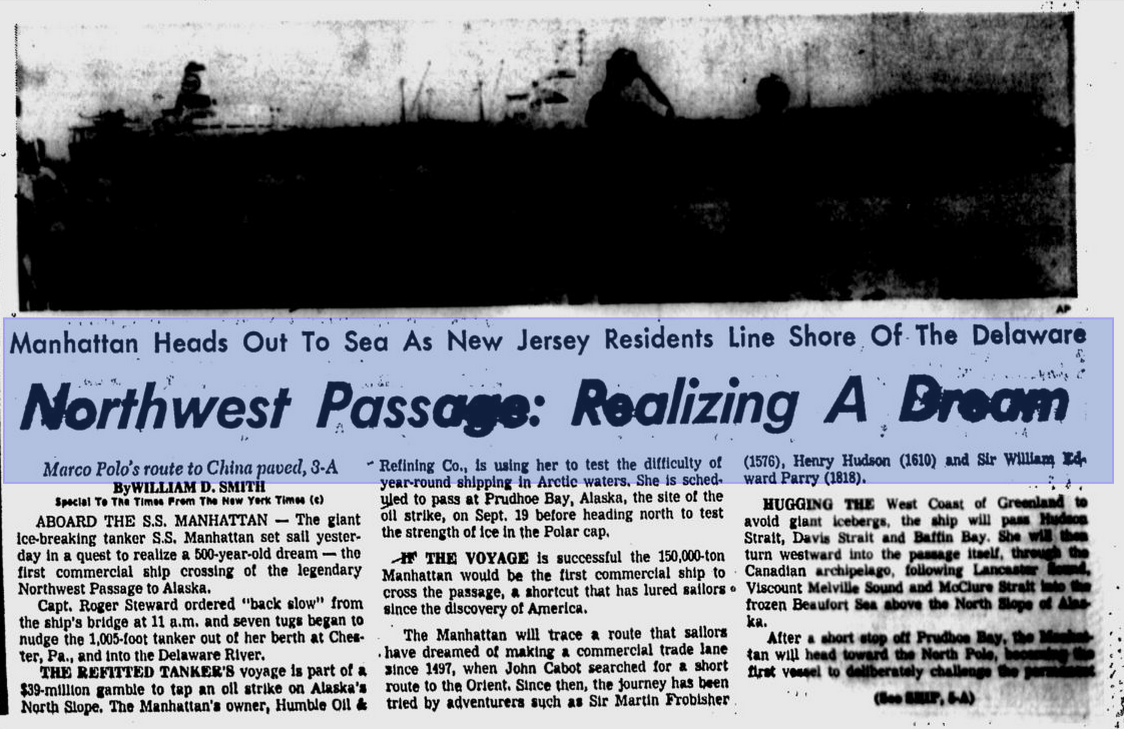
The SS Manhattan
In 1968, the change of government in Canada with the election of Pierre Elliott Trudeau as Prime Minister, combined with the discovery of oil on Alaska’s North Slope by Atlantic Richfield (ARCO) in October of that year, unleashed competing interests and forces that changed the history of the Arctic and increased Canadian anxieties. Canadian sovereignty in the Arctic was challenged by development in the region and especially investigations as to the most economical means of transporting oil south. The press reported that maps had been issued by US oil companies showing the islands of the North Archipelago as disputed territories. The US State Department denied that such maps, if they existed, had any official standing in the eyes of the United States government.
The Trudeau government had to face a serious crisis with the United States in 1969, when three US and British oil companies (Humble, Atlantic Richfield, and BP) planned to send the Manhattan, a specially reinforced oil tanker, on a test run through the Northwest Passage to Prudhoe Bay, Alaska. It was not the first time a vessel had navigated the Passage, but the Canadian media seized upon it as a sensational story and a potential threat to Canadian sovereignty. The difference this time was that the Manhattan was a commercial vessel, and the US government refused to request official permission to enter the passage. Doing so would have meant de facto US acceptance of Canadian sovereignty over the waters, which the United States had never acknowledged.
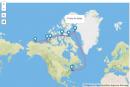
No. 32. Map showing the SS Manhattan’s route through the Northwest Passage. This work was created by Elena Baldassarri in 2014 and is licensed under a Creative Commons Attribution 4.0 International License.
The purpose of the test run was to determine the feasibility of this method of transporting Alaskan oil to markets in the northeast United States. The oil companies sought Canadian cooperation with this project, and as a result of discussions with the Department of Transport, the Canadian icebreaker John A. Macdonald supported the test run of the Manhattan. However, the opposition and the press suggested that the passage of the oil tanker might have adverse implications for Canada’s claims to the northern waters.

No. 33. The SS Manhattan breaking the ice of the Northwest Passage. Photo taken by Auke Visser, http://www.aukevisser.nl.
Even though the government was well aware of the significance of the test, further arrangements were made to “show the flag” during the test run, including a visit by a group of members of parliament and other Canadian representatives at an appropriate point along the Northwest Passage, and flights by aircraft over the ships involved in the exercise at the points of commencement and termination of their passage through the Arctic Archipelago.

January 2014. © Joe Haupt.
Click here to view source.
This work is used by permission of the copyright holder.
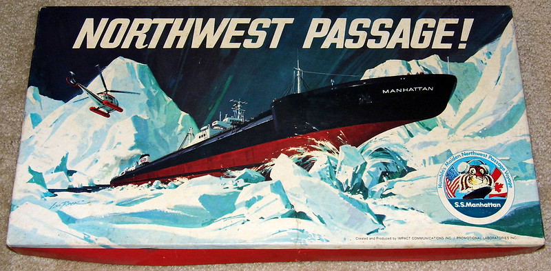
No. 34. The expedition and adventures of the SS Manhattan became the inspiration for a game manufactured by Impact Communications and Promotional Laboratories in 1969. The game’s tasks include bringing oil using an icebreaking tanker from Alaska to Humble City through the Northwest Passage. Whatever happened to the SS Manhattan, the world’s largest icebreaking tanker? Created by Joe Haupt, January 2014.
The Manhattan crisis showed the difficulties connected with de facto sovereignty over Arctic waters and the Northwest Passage. The Canadian government therefore looked for other ways to assert de jure sovereignty. Canada cooperated closely with the United States in rallying support for agreement on narrow territorial seas, and played a very active role in negotiations to define the Law of the Sea, which was the subject of international conferences in 1958 and 1960. The issue was seen in Ottawa as one of control over adjacent waters and in Washington as one of national security.

No. 35. Newspaper headline about the voyage of the SS Manhattan. William D. Smith, “Northwest Passage: Realizing a Dream,” St. Petersburg Times [Pinellas - St. Petersburg], 25 August 1969: front page. Google News Archive.
In 1965, fearing US objections, the Canadian government introduced legislation to establish an exclusive fishing zone along the east and west coasts but not in the Arctic. As reactions in the United States gave no grounds for hope, however, the Canadian parliament went ahead despite Washington’s protests and approved the Arctic Waters Pollution Prevention Act (AWPPA) on 17 June 1970, asserting Canada’s right to regulate all shipping in zones up to 100 nautical miles (185 km) off its Arctic coasts in order to guard against pollution of the region’s coastal and marine resources.
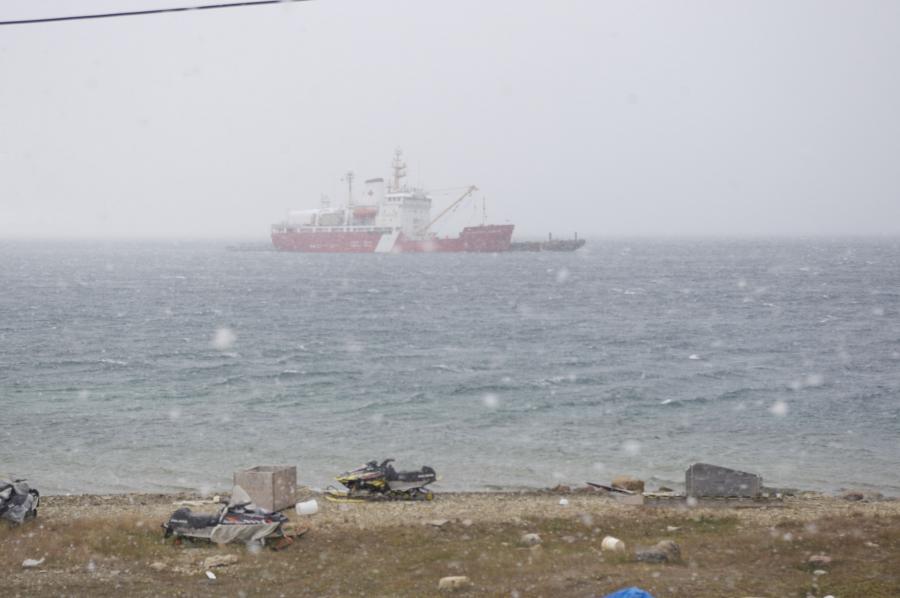
Photo by Enrico Mariotti, 2013.
This work is licensed under a Creative Commons Attribution 4.0 International License.
No. 36. Canadian icebreaker on the coast of Cambridge Bay. August 2013. Photo taken by Enrico Mariotti.
With the passing of the act and associated legislation, the Law of the Sea became a highly politicized issue in both countries. Canada also indicated its support for the regime of innocent passage (the right for peaceful foreign ships to pass through territorial waters) in all straits thus covered by 12-mile territorial seas, taking special care to point out that the Northwest Passage is not an international strait. The AWPPA represented the Liberal government’s “functional” approach to Canadian sovereignty. It presented the Arctic as an ecologically delicate region and suggested that it was important for Canada to extend its jurisdiction northward in order to ensure that foreign vessels did not pollute Canadian waters. The AWPPA also enabled Canada to regulate and control future tanker traffic through the Northwest Passage by creating a pollution prevention zone outside the archipelago as well as in the waters between the islands. The United States and other major maritime powers (notably the UK and Japan) objected to Canada’s unilateral assertion of anti-pollution jurisdiction in the waters of the Arctic Archipelago. Canada attempted to counter these objections and to secure international acceptance of its Arctic water legislation by convening a multilateral conference intended to secure agreement on a treaty that would open an international legal “umbrella” over the Canadian legislation.
The North’s relevance to US policy increased in the early 1980s with the Reagan administration’s efforts to confront the Soviet Union more actively, in particular in the maritime domain. The year 1981 saw the deployment of the Typhoon-class nuclear-powered ballistic missile submarine (SSBN), the first Soviet vessel specifically designed for under-ice operations and equipped with long-range submarine-launched ballistic missiles (SLBMs). This development gave rise to serious concerns about the defense of the Arctic. The Canadian Arctic offered an ideal position for the launching of missiles against targets on the East Coast unimpeded by any significant Western anti-submarine warfare assets.
US naval strategy underwent a significant and aggressive shift towards Arctic operations, not least as a reaction to this Soviet build-up, and increased US activity in the Arctic gave rise to strengthened expressions of Canadian national interest. Public outcry led to confrontation with the United States in 1985 when an icebreaker, the US Coast Guard cutter Polar Sea, navigated the Northwest Passage from Greenland to Alaska without formal authorization from the Canadian government, forcing the Canadian Mulroney government to negotiate with the USA in an atmosphere of public hostility and intense political pressure.
Interest in the North decreased with the end of the Cold War and the slackening of tension in the area. The United States was engaged for some years in the development of a new strategic policy in which the Arctic had no vital place. Cooperation on issues such as environmental protection and sustainable development became significant as the Arctic Council was established in 1996.
No. 37. The North Warning System became operational in 1985 and was completed in 1992 as the successor of the DEW Line. Canada and the United States share the information collected by the NWS in the North American Aerospace Defense Command (NORAD). This work was created by Enrico Mariotti in 2014 and is licensed under a Creative Commons Attribution 4.0 International License.
The Bush and Obama administrations have revised the US Arctic policy, not least as a result of the increased attention focused on the region by other powers—most importantly Russia—and new awareness of the region’s potential as a source of energy.
Joint military exercises have been carried out by Norway, Russia, Canada, the United States, and Denmark within the framework of military cooperation between the Arctic states. Eagle Vigilant, the first such exercise to include Russia, practiced coordinating responses to the scenario of terrorists hijacking planes in the Arctic air space.
The Bush and Obama administrations have revised the US Arctic policy, not least as a result of the increased attention focused on the region by other powers—most importantly Russia—and new awareness of the region’s potential as a source of energy. Both presidents declared on various occasions that the United States has fundamental national security interests in the Arctic region.

Click here to view source.
 This work is licensed under a Creative Commons Attribution-NonCommercial 3.0 Unported License.
No. 38. Arctic Search and Rescue Delimitation Map. The map shows the Arctic Search and Rescue Agreement areas of application. The Search and Rescue (SAR) Agreement is the first legally binding agreement established under the auspices of the Arctic Council. It was signed on 12 May 2011 at the Arctic Council Nuuk Ministerial Meeting. Source: Arctic Portal.
While it is no longer believed that North America is in danger of imminent attack or invasion via the Northwest Passage, Canada and the United States must devote ships and personnel to operations in the Arctic, mostly under the terms of the Arctic Search and Rescue Agreement signed by the members of the Arctic Council in 2011. At the same time, the safeguarding of neighboring waters is the responsibility of the Canadian and US coast guards with support from the new offshore patrol boats and the underwater protection of US submarines.
Inuit Perspectives
What does security mean to Inuit? Security doesn’t come from the comfort that some find in icebreakers, sonar detectors, and Arctic military capabilities. Security from our societal perspective comes from access to the basic essentials of life—food, shelter, and water.
—Udloriak Hanson, Co-Chair of the Arctic Peoples and Security Research Pillar, Munk-Gordon Arctic Security Program
Indigenous people represent the mainstay of human security in the Canadian North. This aspect of security relates to the relationship between corporate development projects and indigenous political power and control over the environment, resources, and land rights.
Historically, Inuit living on the land faced several dangers: predators, starvation, migration of animals, and fluctuations in wildlife populations. All of these factors were outside human control, and the security of the people came from their ability to predict them and to adapt. The awareness of, and respect for, such dangers were part of Inuit culture and history. Today some of the dangers of living on the land have been modified by modern technologies, but newer dangers have emerged.
Indigenous and regional governance, co-management boards, land claims, respect for traditional knowledge, sustainable industrial projects, and the opportunity for employment, education, and health services have become even more important today for the future of the Arctic.
The problem is that the northern populations feel insecure today because of climate change, conflict over maritime borders, and threats to traditional livelihoods such as hunting. At the same time, they are faced with mega-projects, such as diamond mining, which bring jobs, training programs, education, and health facilities to the North on the one hand, but come with high costs in terms of health and the environment on the other.
The problem is that the northern populations feel insecure today because of climate change, conflict over maritime borders, and threats to traditional livelihoods such as hunting. At the same time, they are faced with mega-projects, such as diamond mining, which bring jobs, training programs, education, and health facilities to the North, but come with high costs in terms of health and the environment.
In a broader sense, the real test of human security in the North is whether the economic gains made over the last two decades will increase partnership at the local, regional, and indigenous levels. To achieve this, it will be necessary to redirect attention from the problems of military security in the North to the realities of food, economics, and human security in a broader sense. In order to do so, it will be necessary to divert investment from industries to knowledge in a real attempt to ensure that the northern communities enjoy more of the benefits of development.
No. 39. Video on social environmental security. Climate change impacts nature and people who live in the arctic. Video by Elena Baldassarri. August 2013. Interviews with: Diego Creimer and Cecilia Hagaluk. This work is licensed under a Creative Commons Attribution 4.0 International License.
The Northwest Passage: Myth, Environment, and Resources
This exhibition tells the story of the Northwest Passage from the pursuit of a myth to the exploitation of natural resources. Historian Elena Baldassarri takes readers on a multimedia tour of the Arctic, featuring interactive maps, photographs, videos, and interviews with experts, scholars, and elders of Cambridge Bay, Nunavut, Canada.
Elena BaldassarriAbout the author


